🦌 Wildlife Surveys
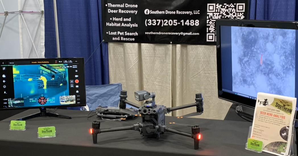
Thermal Drone Herd Analysis Backed by Data—Not Guesswork
Why Choose SDR
🥇 First in the South to offer this
🚁 Best-in-class DJI Matrice 30T
🧠 Run by lifelong hunters who understand whitetail behavior
📍 Every animal mapped, counted, and delivered as a report
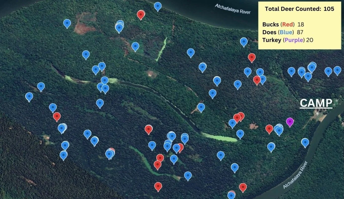
Think you know your herd numbers on your land? Most landowners don’t—until they see the data.
Southern Drone Recovery delivers thermal herd surveys backed by GPS mapping and real data. No guesses. No games.


Deliverables
What You’ll Get in Every Survey:
- ✅ Accurate deer counts using thermal and RGB zoom cameras
- ✅ Buck/Doe ratio breakdown
- ✅ Color-coded satellite map (red, blue, purple pins)
- ✅ Google Earth or favorite hunting app-compatible KML file
- ✅ Thermal and high-res photos
- ✅ Full survey flight path